Forecasting of Tropospheric Delay Using AI Foundation Models in Support of Microwave Remote Sensing
Forecasting of Tropospheric Delay Using AI Foundation Models in Support of Microwave Remote Sensing
Global Tropospheric Delay based on AI Models
Approach

The solution first obtains the initial field, then feeds it into the foundation model for inference. Using the forecast atmospheric state output by the inference, it computes to generate real-time and forecast tropospheric delay products—such as zenith delay, mapping functions, and gradients—as well as weighted mean temperature and precipitable water vapor.
Products
The product format follows the VMF3 standard and is available in both grid-wise and site-wise versions. The site-wise version includes additional GNSS stations from NGL and radiosonde stations from IGRA. In addition to three AI foundation model-based versions, the product also offers the ERA5-based version.

In addition to providing products on global grid points, it also offers site-wise products, covering stations from four geodetic techniques (GNSS, VLBI, SLR, DORIS), as well as over 22,000 GNSS stations from NGL and more than 2,600 radiosonde stations from IGRA. The geographical distribution of these stations is shown below.
The current version supports the following tropospheric delay parameters:
A Demo of the Products

Abstract
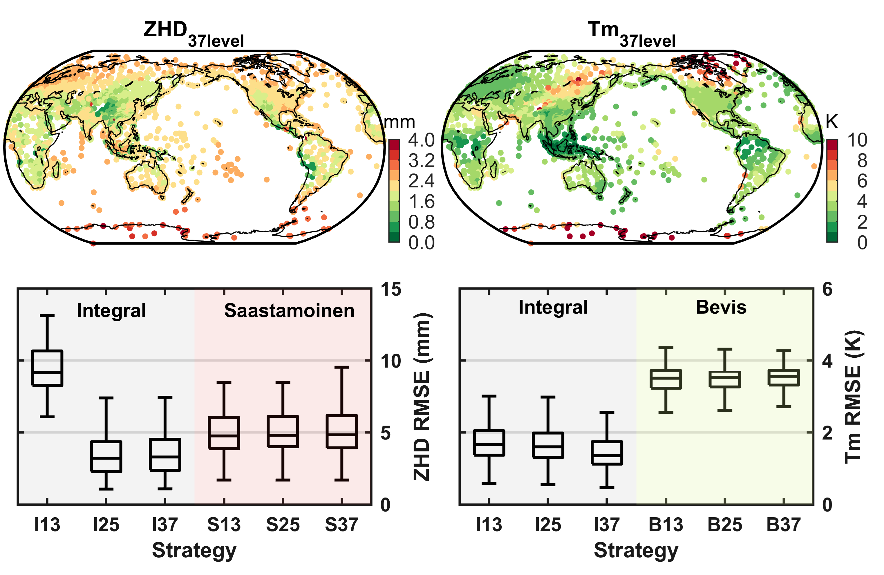
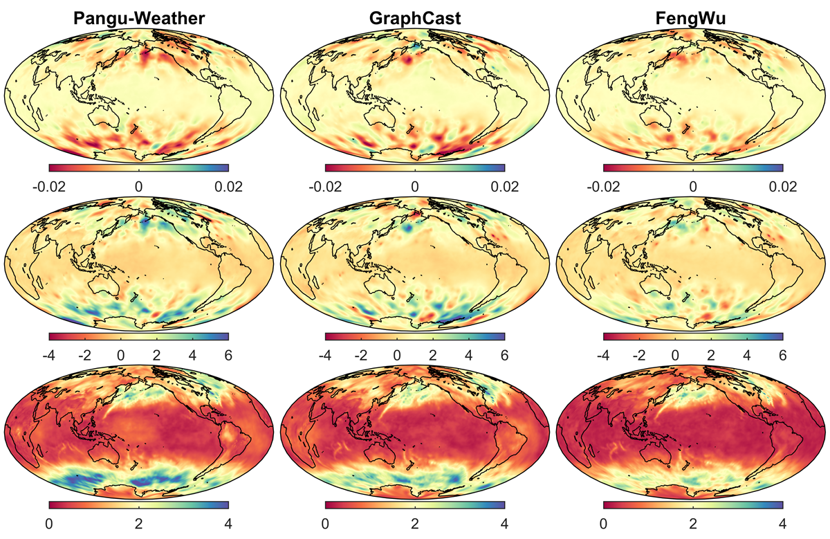
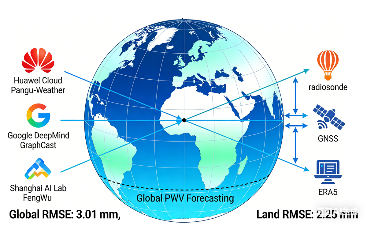
This paper presents for the first time a geodetic and remote sensing tropospheric delay correction scheme based on AI weather forecast foundation models. Based on three foundation models, namely Pangu-Weather, GraphCast and FengWu, the tropospheric delay parameters for the entire year of 2022 were calculated, including zenith delay, mapping function and horizontal gradient, and the new scheme was evaluated and tested. The results show that the new scheme can generate high-precision 15-day 6-hour resolution tropospheric delay forecasts for any location on the globe within minutes at the user's local site. The forecast results are superior to the current best forecast model product VMF3_FC in terms of forecast length, forecast delay and accuracy. We suggest using the scheme proposed in this paper to replace the existing forecast product generation methods. In addition, we also suggest that users with the conditions and needs can bypass the mapping function model and gradient model and directly calculate the slant path delay at the user's local site to avoid the errors brought by these two types of models and grid interpolation. The number of pressure levels supported by the model and the accuracy of the initial input NWM are very important for tropospheric delay forecasting based on large models. We hope that more large models supporting 37-layer input will emerge in the future. In addition, increasing the weight of space geodetic observations in NWM numerical assimilation will also help improve the accuracy of this scheme.
Related Projects
Related Links
BibTeX
Total Visits: